- Trois-Rivières
- Saint-Claude
- Terre-de-Haut
- Grande Anse
- Baie-Mahault
- Petit-Bourg
- Sainte-Anne
- Grand-Bourg
- Le Raizet
- Sainte-Rose
- Saint-François
- Boisvin
- Siege of Guadeloupe
The siege of Guadeloupe took place from March to May 1703 during the War of the Spanish Succession, when an English expeditionary force led by Christopher Codrington landed on Guadeloupe in the French West Indies, and laid siege to the capital of Basse-Terre. Charles Auger, the F
- Lézarde (Guadeloupe)
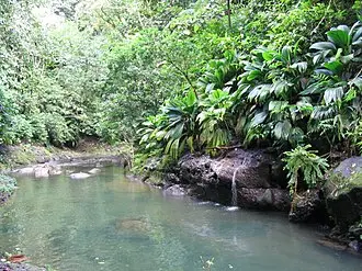
The Lézarde is a river of Guadeloupe. 25.4 kilometres (15.8 mi) in length, it is one of the most important rivers in Guadeloupe, which flows into the town of Petit-Bourg and into the Caribbean Sea on the east coast of the island. It bears its name from the way it winds between ro
- Sainte-Anne, Guadeloupe
Sainte-Anne (French pronunciation: [sɛ̃t an]; Guadeloupean Creole: Sentann') is a city in the southern part of Grande-Terre, Guadeloupe in the French West Indies. It is one of the most popular tourist destinations of the island, along with Le Gosier and Saint-François. The commun
- Basse-Terre
Basse-Terre (, bas-TAIR; French: [bɑstɛʁ] ; Guadeloupean Creole: Bastè [bastɛ]) is a commune in the French overseas department of Guadeloupe, in the Lesser Antilles. It is also the prefecture (capital city) of Guadeloupe. The city of Basse-Terre is located on Basse-Terre Island,
- Les Saintes Passage
Les Saintes Passage (French: Canal des Saintes) is a strait in the Caribbean. It separates the archipelago of Îles des Saintes, from Basse-Terre Island (Guadeloupe). To ensure control of Les Saintes Passage, France built Fort Napoléon des Saintes.
- Marie-Galante
Marie-Galante (French pronunciation: [maʁi ɡalɑ̃t], Guadeloupean Creole: Marigalant) is one of the dependencies of Guadeloupe, an overseas department of France. Marie-Galante has a land area of 158.1 km2 (61.0 square miles). It had 11,528 inhabitants at the start of 2013, but by
- Petite-Anse, Terre-de-Bas
Petite-Anse (French pronunciation: [pətitɑ̃s]) is a quartier of Terre-de-Bas Island, located in Îles des Saintes archipelago in the Caribbean. It is located in the western part of the island. The commercial activity of the island are focused on this village, shops, market, bakeri
- Fond-du-Curé
Fond-du-Curé (French pronunciation: [fɔ̃ dy kyʁe]) is a quartier of Terre-de-Haut Island, located in Les Saintes, Guadeloupe. It is located in the central part of the island. This is the main village of Terre-de-Haut Island. It is a natural anchorage in the bay of Les Saintes. Th
- Battle of Guadeloupe (1779)
The Battle of Guadeloupe or the Action of 21–22 December 1779 was a naval engagement that took place off the French island of Guadeloupe in the Caribbean during the American Revolutionary War between three Royal Navy ships and three French Navy frigates. The Royal Navy under Josh
- Guadeloupe National Park
Guadeloupe National Park (French: Parc national de la Guadeloupe) is a national park in Guadeloupe, an overseas department of France located in the Leeward Islands of the eastern Caribbean region. The Grand Cul-de-Sac Marin Nature Reserve (French: Réserve Naturelle du Grand Cul-d
- Vieux-Fort, Guadeloupe
Vieux-Fort (French pronunciation: [vjø fɔʁ]; Guadeloupean Creole: Vyéfò) is a commune in the French overseas department of Guadeloupe. It is located on Basse-Terre Island.
- Saint-Louis, Guadeloupe
Saint-Louis (French pronunciation: [sɛ̃ lwi] ; Guadeloupean Creole: Senlwi) is a commune in the overseas department of Guadeloupe. Saint-Louis lies on the north of the island of Marie-Galante, and is the island's largest commune. Many beaches lie on the west coast of the commune.
- Notre Dame de l'Assomption, les Saintes
Notre-Dame de l'Assomption (French for Our Lady of Assumption) is a Roman Catholic Church of the Îles des Saintes, an island in the archipelago of the French Overseas department of Guadeloupe. It is located in rue Jean Calot in Fond-du-Curé, a quartier (locality) of Terre-de-Haut
- Îles des Saintes
The Îles des Saintes (pronounced [il de sɛ̃t]; lit. 'Islands of the (Female) Saints'), also known as Les Saintes (Antillean Creole: Lésent, pronounced [lesɛ̃t]), is a group of small islands in the archipelago of Guadeloupe, an overseas department of France. It is part of the Cant
- Lamentin
Lamentin (French pronunciation: [lamɑ̃tɛ̃]; Guadeloupean Creole: Manten or Lamanten) is a commune in the French overseas department and region of Guadeloupe. It is part of the agglomeration of Pointe-à-Pitre, in the north part of Basse-Terre. Three islets are included in the comm
- Fort Delgrès
Fort Delgrès (or Fort Louis Delgrès; formerly Fort Saint-Charles) is a French fort overlooking the town of Basse-Terre in Guadeloupe. It was a key site in the Franco-British struggle in the Caribbean, and later in the resistance of the Guadeloupeans led by the Louis Delgrès, who
- Lac Flammarion
Lac Flammarion is a volcanic crater lake in Guadeloupe, which straddles the communes of Gourbeyre and Capesterre. It is situated at an altitude of 1,103 metres (3,619 ft), and measures 90 metres (300 ft) by 70 metres (230 ft). The lake is entirely filled by rainfall, which is usu
- Grande-Anse, Terre-de-Bas
Grande-Anse (French pronunciation: [ɡʁɑ̃dɑ̃s]) is a quartier of Terre-de-Bas Island, located in Îles des Saintes archipelago in the Caribbean. It is located in the eastern part of the island. Some grocery, bakery and restaurant are located on this village.
- Terre-de-Haut Island
Terre-de-Haut Island (French pronunciation: [tɛʁ də ʔo]; Guadeloupean Creole: Tèdého; also formerly known as Petite Martinique) is the easternmost island in the Îles des Saintes, part of the archipelago of Guadeloupe. Like name of neighboring Terre-de-Bas Island, name Terre-de-H
- Gourbeyre
Gourbeyre (French pronunciation: [ɡuʁbɛʁ]; Guadeloupean Creole: Goubè) is a commune in the French overseas region and department of Guadeloupe, in the Lesser Antilles. It is a suburb of the city of Basse-Terre. The commune of Gourbeyre was in the past a pivotal point in the defen
- Rivière du Petit Carbet
Rivière du Petit Carbet is a river of Guadeloupe. The river's source is at La Grande Soufrière. It is 9.0 km (5.6 mi) long. It flows through Guadeloupe National Park, traversing the commune of Trois-Rivières in southern Basse-Terre, before flowing into the Caribbean Sea between S
- Fort Napoléon des Saintes
Fort Napoléon (in French: Fort Napoléon des Saintes) is a fortification, located on Terre-de-Haut Island, in the Îles des Saintes, Guadeloupe. Property of the Departmental Council of Guadeloupe, it has been classified as a historical monument since the December 15, 1997. Fort Na
- Palace of the General Council
The Palace of the General Council (French: Palais du conseil général) is the base of the Departmental Council of Guadeloupe.
- Grande-Anse, Terre-de-Haut
Grande-Anse (French pronunciation: [ɡʁɑ̃dɑ̃s]) is a quartier of Terre-de-Haut Island, located in the Îles des Saintes archipelago in the Caribbean. It is situated in the eastern part of the island. The island's cemetery and the terminal of Les Saintes Airport are located in Grand
Museums, religious and historic sites, nature — with photos, descriptions and directions








By continuing to use the Platform, you agree to cookies and similar technologies. If you do not agree, discontinue use.
VIDI Privacy Policy
·
VIDI Cookie Policy
By continuing to use the Platform, you agree to cookies and similar technologies. If you do not agree, discontinue use.
VIDI Privacy Policy
·
VIDI Cookie Policy