- Roseau
- Canefield
- Mahaut
- Portsmouth
- Salisbury
- Marigot
- Berekua
- Saint Joseph
- Roseau Cathedral
The Cathedral of Our Lady of Fair Haven of Roseau, originally known in French as Église de Notre-Dame du Bon Port du Mouillage de Roseau, is a Roman Catholic cathedral in Roseau, the capital city of Dominica in the Caribbean. The church is the see of the Diocese of Dominica, suff
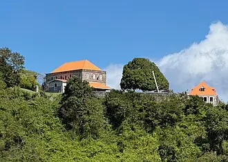
- Fort Shirley (Dominica)
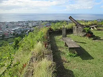
Fort Shirley is a historic military outpost on the Caribbean island of Dominica. It was built by the British in 1765, and was named for Sir Thomas Shirley. The fort was the location of the 1802 revolt of the 8th West India Regiment. Today, Fort Shirley is part of Cabrits National
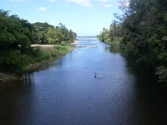
- Pagua River
The Pagua River is one of the longest rivers on the Caribbean island of Dominica. It originates in the D'Leau Gommier area of the Central Forest Reserve, where it shares the same watershed as the Layou River. The Pagua flows northeastward, forming the western boundary of the Car
- Bagatelle, Dominica
Bagatelle is a village in Saint Patrick Parish, Dominica.
- Layou River
The Layou River is a river in Dominica. It rises in the interior of the country, flowing westward to reach the Caribbean Sea on the country's central western coast, very close to the town of St. Joseph. It is the longest and deepest river in Dominica. With a total length of 27.6
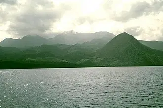
- Morne Diablotins
Morne Diablotins is the highest mountain on the Caribbean island of Dominica, and the island's largest and highest volcano. It is the second highest mountain in the Lesser Antilles. Its summit is 1,447 m (4,747 ft) above sea level. It last erupted c. 30,000 years ago. It takes
- Morne Trois Pitons National Park
Morne Trois Pitons National Park is a national park in Dominica established in July 1975, the first to be legally established in the country. It became a World Heritage Site in 1997. The park is named after its highest mountain, Morne Trois Pitons, meaning "mountain of three peak
- Morne Bruce
Morne Bruce is a hillside enclave located in Roseau, Dominica. It offers a panoramic view of the city and the Caribbean Sea beyond. The site was once home to the military garrison that protected Roseau. Remains of the original barracks and officers' quarters can still be seen tod
- Cabrits National Park
Cabrits National Park is on a peninsula at the north end of the Caribbean island of Dominica, north of Portsmouth. The park protects tropical forest, coral reefs and wetlands. There are hiking trails and an English garrison called Fort Shirley.
- Toulaman River
The Toulaman River is a river in Dominica. Its source is in the Morne Diablotins. It empties into the sea on the northeastern coast, north of Marigot.
- Morne Plat Pays
Morne Plat Pays is a volcano on the island of Dominica. Located on the southern region of the island, the volcano last erupted around the year 1270 AD. Since the mid-18th century, a number of earthquake swarms have occurred near the mountain, but these are not related to Morne Pl
- Morne Rachette
Morne Rachette or Morne Raquette is a village on the west coast of Dominica, in the northwest corner of Saint Joseph Parish. It is located on the slopes of Morne Jalousie, above Coulibistrie to its immediate north and Batalie Bay. The village of Salisbury is south of Morne Rachet
- Fort Young Hotel
Fort Young Hotel is a hotel on the quayside of Roseau, Dominica, in the southern part of the capital next to Garraway Hotel, Dominica Museum, the Roseau Public Library, just south of the Governor's Residence and Roseau Cathedral. Located within the ramparts of the old colonial mi
- Indian River (Dominica)
The Indian River is a river on the Caribbean island of Dominica. It flows to the Caribbean Sea between the town of Portsmouth and the village of Glanvillia. The Indian is the widest river in Dominica. Indian River boat rides are one of tourist attractions of Dominica. Some of the
- Galion, Dominica
Galion, also spelled Gallion, is a mountain village in the south of Dominica, with a population of 134.
- Dominica Botanical Gardens
Dominica Botanic Gardens is located on the Caribbean island-nation of Dominica, in the capital of Roseau. Once known as one of the finest botanical gardens in the region, it was severely damaged by Hurricane David in 1979. Following restoration efforts, it remains a focus of cult
- Morne aux Diables
Morne aux Diables, also known as Devil's Peak, is a volcano on the island of Dominica and the volcanic formation is the northernmost peak on the island. The volcano is considered dormant, with no unusual volcanic activity reported aside from a swarm of small earthquakes detected
- The Dominica Museum
The Dominica Museum is the national museum of Dominica, an island nation in the Caribbean Lesser Antilles. It is located in the capital, Roseau, on a quay in front of the Old Market of Roseau, which was the centre for slave trading during colonial times. Its building was formerly
- Government House, Dominica
The State House, located in Roseau, is the official residence of the president of Dominica. Previously it was used as the official residence of the colonial governors of Dominica.
- Invasion of Dominica (1761)
The Invasion of Dominica was a British military expedition to capture the Caribbean island of Dominica in June 1761, as part of the Seven Years' War.
- Saint Joseph, Dominica
Saint Joseph is the chief settlement of Dominica's St. Joseph Parish. Its population is 2,029.
- Canefield Airport
Canefield Airport (IATA: DCF, ICAO: TDCF) is an airport on the west coast of the Caribbean island nation of Dominica. It is 3 miles (5 km) north of Roseau, the capital. It is one of only two airports in the island nation of Dominica, the other being Douglas–Charles Airport.
- Marigot, Dominica
Marigot is the largest settlement of Saint Andrew Parish in northeastern Dominica. The village has a population of 2,676 people, and is home to a Fisheries Complex as well as the island's main airport. Kokoy is the main language spoken in the village, a dialect of Antiguan and B
- Coulibistrie
Coulibistrie is a village on the west coast of Dominica, in the northwest corner of Saint Joseph Parish. It is between the villages of Colihaut to the north and Morne Rachette to the south. It extends inland from the coast within a deep valley, along both banks of the Coulibistri







By continuing to use the Platform, you agree to cookies and similar technologies. If you do not agree, discontinue use.
VIDI Privacy Policy
·
VIDI Cookie Policy
By continuing to use the Platform, you agree to cookies and similar technologies. If you do not agree, discontinue use.
VIDI Privacy Policy
·
VIDI Cookie Policy